Government Affairs

Government Affairs

  • Home
  • News
  • White Papers
  • WeSERV Main Page
News Ticker
  • [ March 22, 2024 ] Election Timeframes and Deadlines – 2024 Candidates & Elections
  • [ March 18, 2024 ] Wage Earner Housing, New Laws, Candidate Interviews, and a Special CAP CE Event GAD Podcasts
  • [ March 1, 2024 ] Changes to the Primary and General Election Calendars – 2024 Candidates & Elections
  • [ February 22, 2024 ] Douglas – Time is Running Out to Secure Grandfathered Water Rights City News
  • [ February 14, 2024 ] Arizona’s Primary has been Moved Up, Candidates, Elections, NAR Midyear Legislative Meetings & Arizona REALTORS Conference 2024 GAD Podcasts
  • Facebook
  • Twitter
  • LinkedIn
  • RSS Link
HomeCity NewsMaricopa County Interactive Land Use Map

Maricopa County Interactive Land Use Map

February 1, 2017 Liz Recchia City News, County, Maps

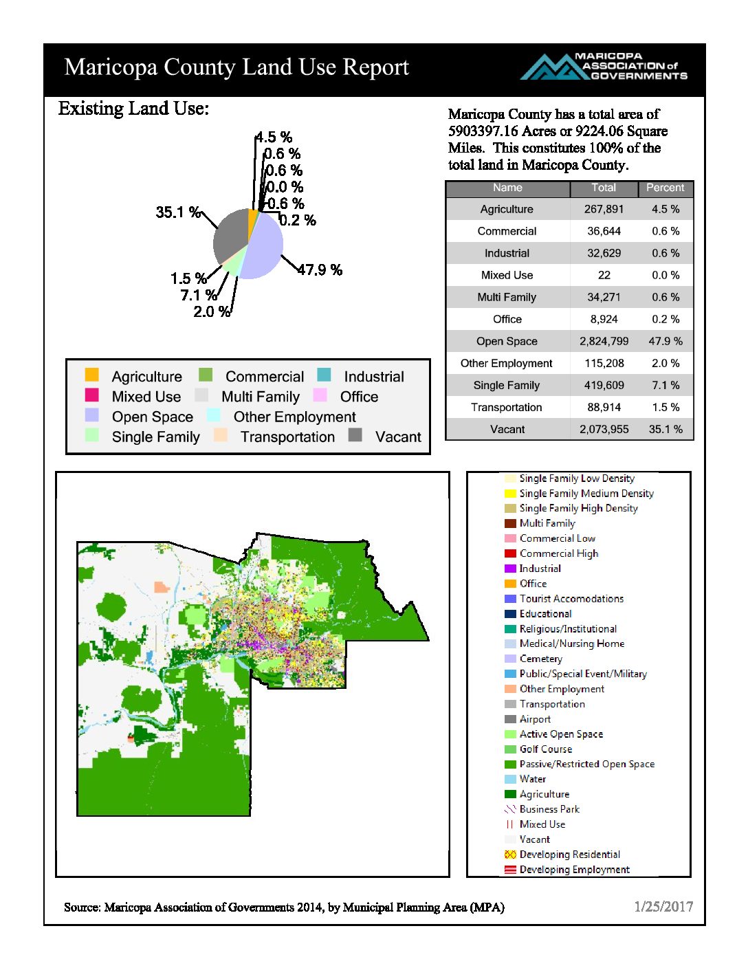
@MAGregion MAG (Maricopa Association of Governments) has an easy to use interactive land use map covering all of Maricopa County.

Create maps and reports by County, City or create your own customized map. The map shows current and future land use. Now when your client wonders what is going to happen to the empty lot across the street, they can find out.

Previous

Where Is ____? How Far Is ____? County Interactive Map Answers These Questions!

Next

City of Glendale City Services Interactive Map

Monthly Archives

  • Home
  • News
  • White Papers
  • WeSERV Main Page

Copyright © 2016 | WeMAR Government Affairs