In 2019 the Arizona State Legislature passed, the Governor signed and the United States Department of Interior approved the DCP, the Drought Contingency Plan. CAP and the Arizona Department of Water Resources authored a short video discussing the DCP.
One of the provisions was a plan by the lower basin states and Mexico to share in water cutbacks, if needed, between 2020 and 2026. Now it seems, Arizona water cutbacks will begin in January 2022.
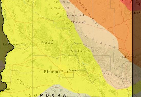
You can access the Arizona drought map and search specific cities, counties and zip codes for drought conditions on drought.gov. There are a variety of maps you and your clients can access: Long Term drought, short term drought, Agriculture commodities overlayed on drought areas, and water supply by stream flow and predicted 30-day precipitation.
You will also find maps for NOAA’s (the National Oceanic and Atmospheric Administration) Climate Prediction Center monthly and seasonal drought outlook by county and historical conditions going back to 2000 in the Historical Water Watcher and going back to 1846 at the Global Historical Climatology Network site.
In September 2020, the Colorado River Annual Operating Plan for 2021 was presented by the Bureau of Reclamation. The plan shows the various lakes in the upper and lower basin systems, the amount of water in each lake as of September 2020, and the system storage capacity and amounts.
On May 6, 2021, the Arizona Department of Water Resources published the April 29th Joint Colorado River Shortage Preparedness Briefing. The briefing outlined the water shortage issues along with what declaring a Tier 1 shortage will mean for Arizona.
CAP and ADWR authored a Colorado River Shortage Fact Sheet you can read for more information, but here are the highlights:
Arizona will have a substantial cut to its Colorado River water allocation with the bulk of the cuts falling on Central Arizona agriculture water users. For Pinal County agriculture, this will mean their water will be reduced by almost 65% and will need to come from other sources while some agricultural land will become fallow. There is no anticipated water supply issues for cities or tribal communities.
In 2020 and 2021 Arizona has operated at the Tier Zero Colorado River status meaning we do not take 192,000-acre feet of our allocated 2.8-million-acre feet annual Lake Mead entitlement. If the current anticipated Tier 1 cuts occur in 2022, Arizona will further reduce its water use from the river to 512,000-acre feet. This water is about 30% of the water that flows though the CAP canals and represents about 18% of Arizona’s Colorado River supply.
As part of DCP, Arizona formalized the already existing practice of water users conserving a portion of the Lake Mead allocation. You can read the DCP on how Arizona will share resources between stakeholders and mitigate future risks at www.weservgad.org.
Are you unfamiliar with Arizona’s water system? You can watch the CAP to TAP event video in which we take you from the water’s Colorado River origin, to groundwater replenishment, through the system to the point the water comes out your faucet.
You can also read more about the basics of Arizona Water in the WeSERV Water Issues Task force flyer Water in Arizona – Is My Property in an AMA or INA?
